Abandoned and orphaned wells, who is qualified to lead the search for them? ISC Geoscience will quickly collect data, identify, and map the wells on your property, and then interpret the results to share what is happening with the site. Put our team’s experience to work. We are recognized across the country, as professional Geophysicists (PgP), Registered Professional Geologists (RPG), and Registered Professional Geoscientists (RPG), and are qualified to complete the work you need completed.
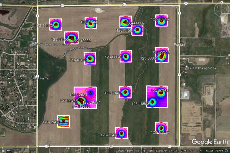
In Colorado, these wells must be identified before land can be developed for other uses. We have 3.7 million abandoned oil and gas wells across the state and ~130,000 of those are orphaned. There are other staggering statistics across the country.
The problem: abandoned, orphaned, and unrecorded wells may act as conduits for the contamination of groundwater supplies by oil field brines and other pollutants. The casings of abandoned wells eventually develop leaks, which, if not properly plugged, can allow pollutants to reach freshwater aquifers that supply drinking water. Sources of pollutants include brine ponds, landfill sites, agricultural activities, industrial activities, illegal disposal sites, or accidental spills. The problem is common in regions where there are old petroleum fields or where water wells have been extensively used for agricultural irrigation. Urban areas can also contain wells that were abandoned and concealed during development.
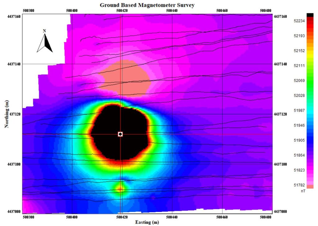
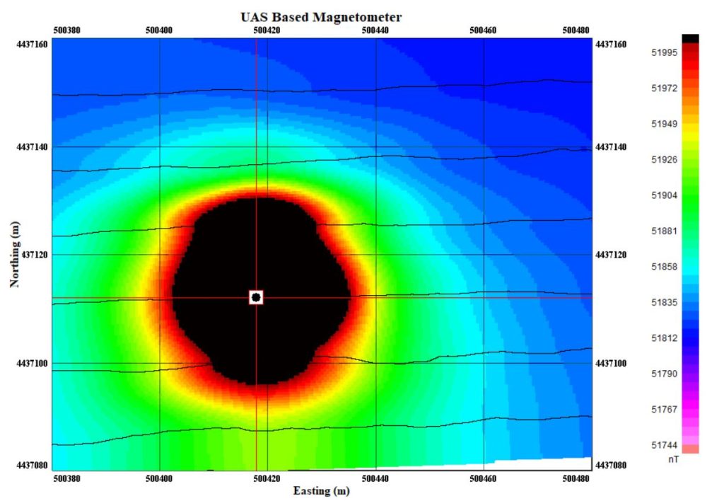
ISC Geoscience designs Unmanned Aerial Magnetic Surveys that can be used to locate these wells by mapping the magnetic disturbances or “anomalies” produced by their steel well casings. In addition to the magnetometer survey, we layer our results with LiDAR and Photogrammetry of the site.
Unmanned Aerial Magnetic Surveying collection methods go by several names.
- Unmanned Aerial Vehicle (UAV)
- Unmanned Aerial System (UAS)
- Drone