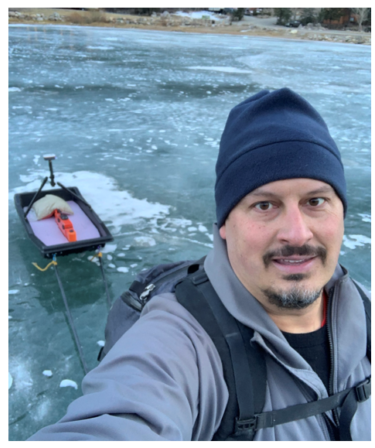
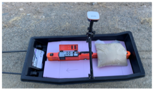
Performed frequency domain electromagnetic induction (FDEM) surveys with a Geonics EM38-MK2 towed on an Otter Pro Sled with cut closed cell foam. A Juniper Systems Geode GNSS receiver was used for positioning, while a Dell ruggedized the data. The data was displayed in real-time and saved with Geomar’s RTmap38MK2 software.
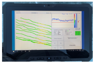
The data was collected at 2m line spacing across the width of the lake. The data was processed and plotted in Petros Eikon QCTool software. The flow path between the upper and lower lakes is visible in the real-time data as increased conductivity due to a larger portion of the sensing volume of the EM38-MK2 being in the water.