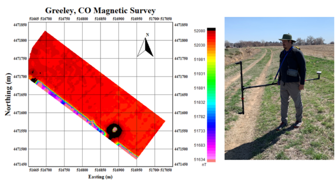
Performed magnetic surveys with two QuSpin Total Field Magnetometers (QTFM) in a vertical gradiometer configuration on a custom-built carry frame to detect abandoned wellheads before new construction. A Juniper Systems Geode GNSS receiver was used for positioning, while a Juniper Systems Mesa 3 ruggedized tablet computer was used to collect the data. The data was displayed in real-time and saved with Geometrics MagLog software.
The data was collected at 10m line spacing with perpendicular tie lines at 30m spacing. The data was processed and plotted in Petros Eikon QCTool software. The wellhead is quite visible in the southern portion of the image. The southwest portion of the grid was along a metal fence that is visible in the data.
Comments are closed, but trackbacks and pingbacks are open.